When we first developed the Accordance Bible Atlas, we knew we needed to include a resource that would give information about the more important site and region names on the map. The other module developer (there were only two of us at the time) was occupied with developing the data for the Atlas, so I was tasked with developing this tool which would come to be called Place Names.
Each of the sites on the Atlas are given an importance ranking on a scale from 1 (least important) to 5 (most important). This ranking is used to determine which sites should be hidden when you zoom out from the map. We decided to use the sites of importance 3 or above as the ones we would cover in the Place Names module. Once I had this list of sites, I then had to research each site and write up a description of its location, history, and overall significance.
The main challenge of developing the Place Names module was the deadline. The Atlas was nearing completion and Place Names had to be finished before it could be released. To meet that deadline, the site descriptions had to be kept pretty basic and concise.
Some time after the release of the Atlas, I was approached with the idea of expanding the work I had done on Place Names into a new resource that would include photos of each site. This new resource would eventually come to be called the Bible Lands PhotoGuide.
I was given a large archive of photographs of Biblical places I had never personally visited, and I had to decide which photos best illustrated each site.
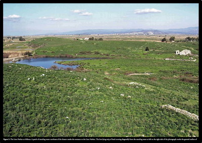
My research often began with the Bible dictionaries I had available in Accordance. Anchor Bible Dictionary was especially good about giving information about the archaeological discoveries at each site, but it had relatively few photos and illustrations. Going from a description of a Bronze Age wall discovered at a site to actually identifying that wall in a photo was next to impossible. I soon was combing through coffee table books and magazines on Biblical archaeology, tourist guide books which might illustrate how a site looks today—anything I could find that would give me clues as to what I was looking at. It would have been easy to annotate each photo with something like “Ruins at Miletus,” but I wanted users of the PhotoGuide to be able to see the outline of the ancient harbor and the surrounding bay which have long since silted up. It’s that level of detail which sets the PhotoGuide apart from the typical illustrated Bible dictionary.
At times it was frustrating finding the information I needed, but I learned more about the Bible doing the research for the PhotoGuide than I ever learned in seminary. If you haven’t explored the PhotoGuide in depth, begin reading through its articles on sites mentioned in your current passage of study. You’ll be surprised how much it can deepen your understanding of the Bible.


